Goosepond Mountain State Park

Diamond Head National Natural Landmark

nationalparkswitht's avatarNational Parks With T

IMG_4439

Welcome back to National Parks & other public lands with T! If you are seeing this on Twitter or Facebook, please visit the blog to see all of the photos and read the story by clicking the link.

IMG_4431

Diamond Head is a dormant volcano crater. It provides the iconic backdrop to Waikiki Beach on the island of Oahu.

IMG_4153

Hawaiians called the crater ‘Le’ahi’ (Tuna Ridge, because it resembles the fin of a tuna.) Western explorers thought they saw diamonds sparkling on the crater walls as they approached from the sea which is how it got the name Diamond Head. There were no diamonds.

IMG_4490

The military built the trail to the top in 1908 and defensive bunkers were built at the summit during World War II. There are still antennae up there in use by the government.

IMG_4459

The hike to the summit is the most popular trail on the island, so…

View original post 295 more words

Walkill River National Wildlife Refuge: Liberty Loop Trail

nationalparkswitht's avatarNational Parks With T

2004_1016LibertyLoop0014

Welcome back to National Parks & other public lands with T! If you are seeing this on Twitter or Facebook, please visit the blog to see all of the photos and read the story by clicking the link.

Years ago, I lived in a more rural section of New Jersey, right on the border of Orange County, New York. Wallkill River National Wildlife Refuge was established in the years that I lived there to protect the water quality and manage the waterfowl dependent on the wetlands in the valley. There are several nature trails available for hiking.

2004_1016LibertyLoop0021

While most of the refuge is in New Jersey, the trail head closest to my house was in New York. The 2.5-mile Liberty Loop Trail was created on a sod farm that was allowed to revert to its natural state and is co-aligned with the Appalachian Trail for one mile.

2004_1016LibertyLoop0026

The trail begins on…

View original post 52 more words

Grand Canyon Western Rim: Guano Point


nationalparkswitht's avatarNational Parks With T

IMG_7979

Welcome back to National Parks & other public lands with T! If you are seeing this on Twitter or Facebook, please visit the blog to see all of the photos and read the story by clicking the link.

IMG_7995 
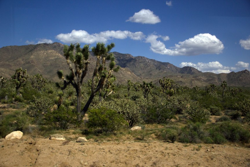
Driving through Joshua Tree National Forest

When we were staying in Las Vegas for a couple of nights, we took a bus trip to the Western Rim of the Grand Canyon. The tour first stopped at the Hoover Dam (You can see my post on the Dam here,) then traveled through Joshua Tree National Forest to get to Grand Canyon West.

IMG_7934

Grand Canyon West is on Hualapai land and is not part of the National Park. Hualapai means ‘People of the Tall Pines.’ The Hualapai reservation was established in 1883.

IMG_7941

Once in Grand Canyon West, we needed to leave the tour bus and use the Hualapai operated shuttles to get around the…

View original post 302 more words

Southern Vermont Covered Bridges — Sharon’s Iconic Travel Photography Blog

What can be 100 years old, has a roof, usually has a single lane, and spans a body of water? If you answered a covered bridge, you are correct. Covered bridges are pieces of history that many times are located in scenic locations. Purpose The purpose of a covering a bridge with a roof and […] … Continue reading Southern Vermont Covered Bridges — Sharon’s Iconic Travel Photography Blog