Harriman State Park: Jackie Jones Loop

Walkill River National Wildlife Refuge: Winding Waters Trail

nationalparkswitht's avatarNational Parks With T

20190309_150633

Welcome back to National Parks & other public lands with T! If you are seeing this on Twitter or Facebook, please visit the blog to see all of the photos and read the story by clicking the link.

20190309_150735

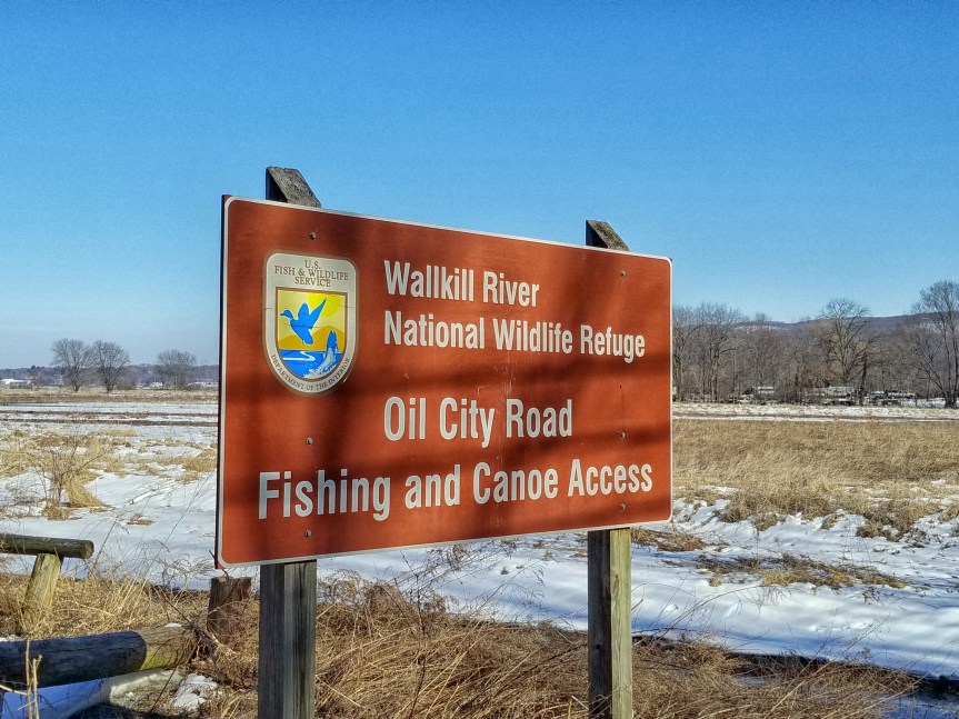
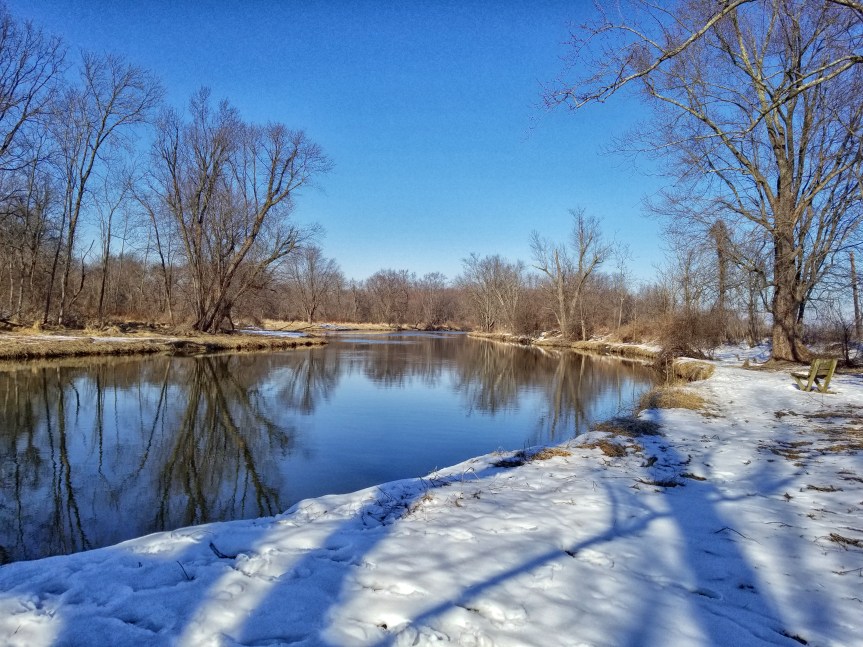
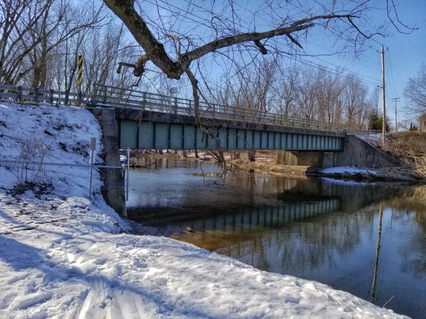
The Walkill River National Wildlife Refuge protects a ten mile stretch of the Walkill River. This river flows north from Sussex County, New Jersey, up into New York State and into a tributary of the Hudson River.

20190309_150640

The Lenape called the river Twischsawkin, or ‘the land of plentiful plums.’ As European settlers moved into the fertile valley, they lowered the water levels by constructing a canal. When the area became a wildlife refuge in 1990, much of the natural area was reclaimed from farmlands.

20190309_150911

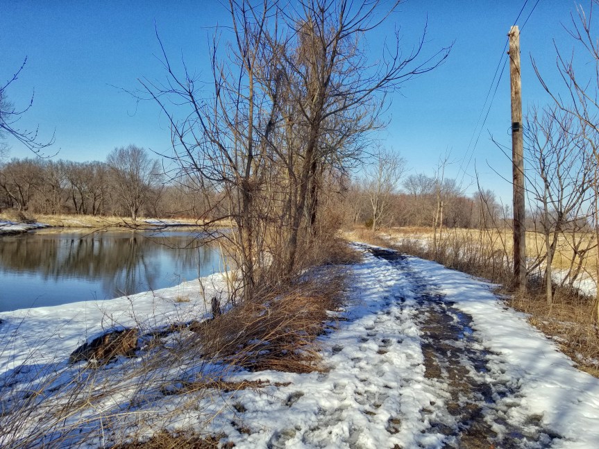
The Winding Waters Trail follows an old farm road up the river and through fields in a 2.1 mile loop. It begins at one of the refuge’s canoe…

View original post 59 more words

Zion National Park: Pa’Rus Trail

nationalparkswitht's avatarNational Parks With T

IMG_8500

Welcome back to National Parks & other public lands with T! If you are seeing this on Twitter or Facebook, please visit the blog to see all of the photos and read the story by clicking the link.

IMG_8515

On our last day in Zion, we spent the morning hiking the strenuous trail to Angel’s Landing (you can see my post about that hike here and here.) We were exhausted from that hike, but still wanted to see more of this beautiful park. After lunch, we rode the shuttle to the Visitor Center and spoke to a ranger about our options.

IMG_8505

He suggested the easy and level Pa’Rus trail. It is 1.8 miles from the Visitor Center and is mostly paved or hard-pack. It was designed to ease congestion during the busy months…it provides a way for hikers and bicyclists to get from the Visitor Center to the car-free section of…

View original post 174 more words

Hawaiʻi Volcanoes National Park: Chain of Craters

nationalparkswitht's avatarNational Parks With T

IMG_5004

Welcome back to National Parks & other public lands with T! If you are seeing this on Twitter or Facebook, please visit the blog to see all of the photos and read the story by clicking the link.

IMG_5006

Chain of Craters Road is a 19-mile road through the East Rift and coastal area of Hawaii Volcanoes National Park on the big island of Hawaii.

IMG_4996

Our tour stopped at the Lua Manu crater on this drive. It is the first crater on the Chain of Craters Road and was formed when, about 200 years ago, the lava beneath it drained leaving an empty chamber. The surface collapsed into the chamber, forming a 125 foot deep pit.

IMG_5002

We walked around on the surrounding lava fields, marveling at the plants growing right up out of the rocks and taking photos by interesting formations.

IMG_4999

Hilo Posts:

View original post 42 more words

Ramapo Mountain State Forest: Ramapo Lake

nationalparkswitht's avatarNational Parks With T

IMG_5966

Welcome back to National Parks & other public lands with T! If you are seeing this on Twitter or Facebook, please visit the blog to see all of the photos and read the story by clicking the link.

IMG_5956

Ramapo Mountain State Forest protects 4,269 acres in the mountainous region of Northern New Jersey. It is in both Passaic and Bergen Counties and is a separate park from the adjacent Ramapo County Reservation.

IMG_5958

There is a well-marked network of trails here. I met up with a local hiking group in the upper lot on Skyline Drive. In my previous visit to this park, I’d begun at the lower lot.

IMG_5948

We followed the yellow Hoeferlin Trail which was a rocky descent from Skyline Drive to Ramapo Lake. Ramapo Lake is a man-made lake. It is 120 acres now and began as a 25-acre pond.

IMG_5957

In the late 1800s, it was known as…

View original post 103 more words